In 2011, a consortium formed by CAUPD and CITIC Construction signed a contract with the provincial government of Luanda, the capital of the Republic of Angola, in the presence of Wu Bangguo, then Chairman of the National People’s Congress (NPC), to provide a package of planning assistance services for Luanda Province, which included the Luanda Province strategic plan, the urban master planning of Gilangbajihi, the master urban design of Gilangba New Town, and the detailed control plan for the central area of Gilangba New Town. Over 20 staff members of CPAI have been sent to Africa several times for status-quo assessments, proposal discussions and plan briefings. The planning activities were unanimously recognized by the Luanda provincial government and other authorities, reflecting the inheritance and development of the traditional friendship between China and Africa, and blaze a new trail in China’s assistance to Africa.
Luanda Province Strategic Plan
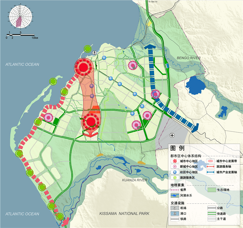
Based on a thorough analysis of Luanda Province, future development opportunities in Africa and the status-quo of major African cities, the plan defines the development objective of Luanda Province, the capital of Angola, as “an African metropolitan toward modernization”, which includes three dimensions: economic revitalization (the establishment of Luanda as a leading city in sub-Saharan Africa), inclusive growth (the fruits of development shared by all), and green city (an ecological development model).
Predicated on the Long-term Development Strategy for Angola (2025) and United Nations studies, the plan forecasts the scale of development of Luanda province, suggesting that by 2025 the population in Luanda metropolitan area will exceed 12 million and that the national government should plan for sufficient job opportunities in response to the trend of industrial development, prepare the necessary space and allocate the appropriate social services and infrastructures.
Based on the multi-scenario analysis, the plan proposes three options: single-center, dual-center and multi-center development models. In the end, Angola chose the dual-center model, which has enough elasticity and is able to cope with future uncertainty in development.
The plan also covers various aspects of urban planning: spatial structure, industrial zone, housing development policy, ecological and green space system, comprehensive transportation system, and major municipal utilities.
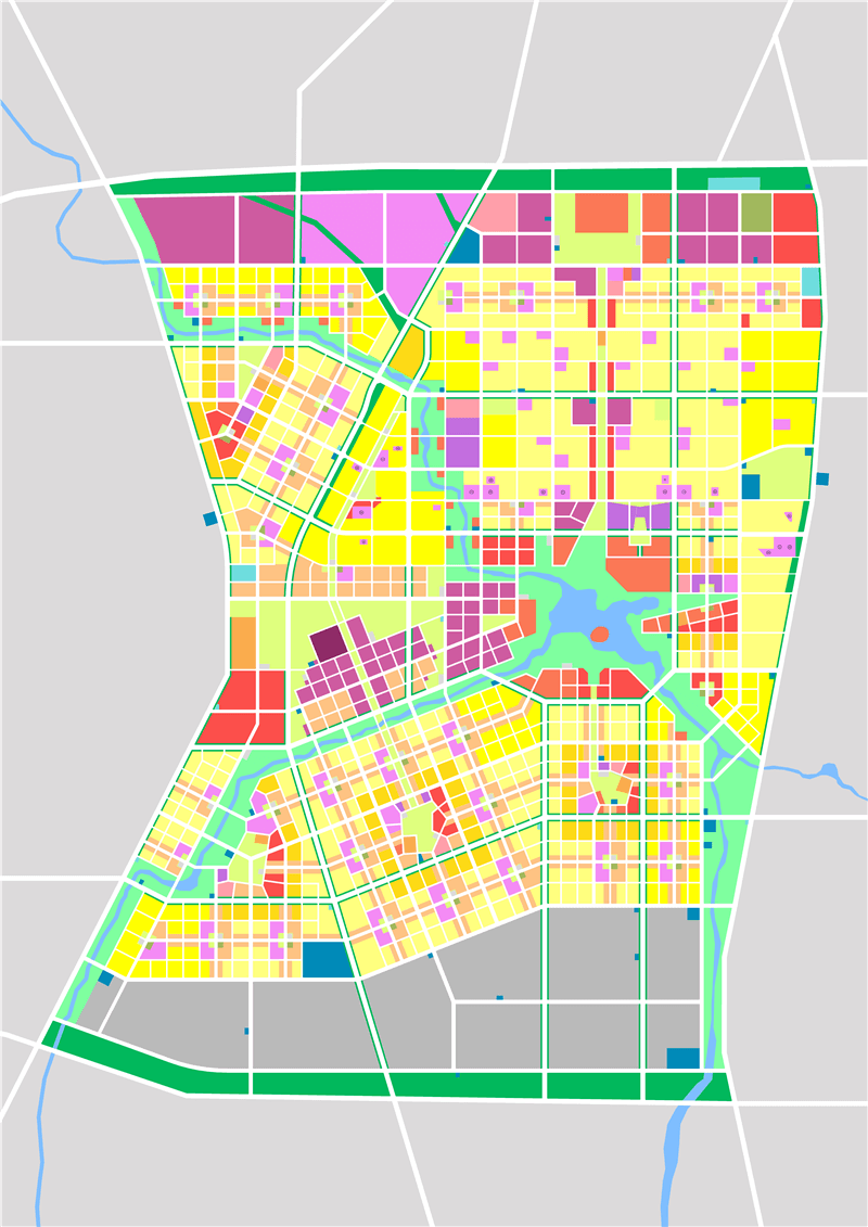
Girangbaja Urban Master Planning
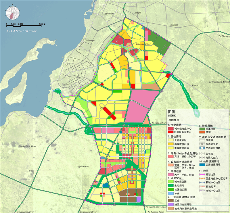
Girangbaja covers an area of 226 km2, which includes both a plenty of slums and numerous newly built areas. The development plan for this area aims to differentiate the function and spatial structure of the new town from the old one, construct the transport and municipal support system and gradually improve service facilities.
The planning begins with explicating the development concept of spatial equity and mixture development. Spatial equity means providing equal opportunities in the urban space for people from all walks of life; and mixture development emphasizes avoiding low-density sprawl of purely residential functions.
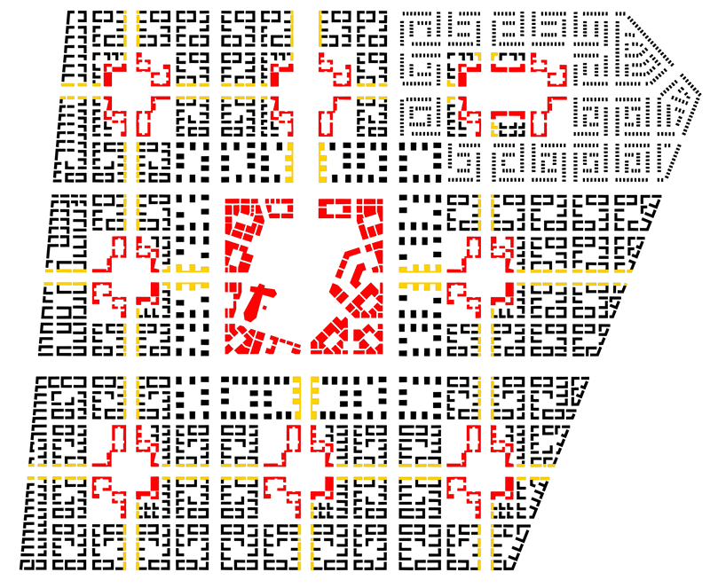
In terms of spatial structure, the planning proposes the “two-city, dual-center” structure. The twin cities refer to the two polarized urban areas respectively in the north and south. Specifically, the north urban area revolves around existing structures (including slums) while the south urban area focuses on future development. The dual center means the two urban areas each plan for an urban center.
In terms of transportation, the planning proposes to open two expressways and two structural trunk roads from north to south, while planning three high-capacity rapid transit corridors to drive the synergistic development of the two urban areas in the north and the south.
In terms of ecology, the planning relies on the existing topography and ditches to build an ecological security system and thereupon completes the design of various types of land.
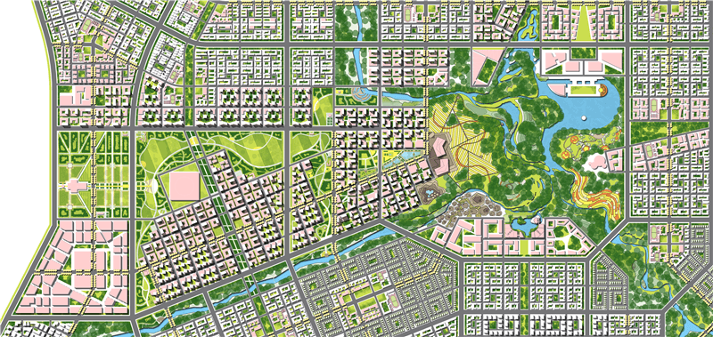
Master Urban Design for Girangba New Town
Girangba New Town follows three main principles in the arrangement of public space: hierarchy, compositeness, and sociality. Hierarchy means that according to the demographic characteristics of Luanda, public spaces are set up at different levels according to different sizes of specific groups, including the city level (serving the whole province), the district level (serving a population of about 100,000) and the community level (serving a population of about 15,000). Compositeness means that the public space is integrated with public service facilities, public transportation, and slow-moving system, which strengthens the appeal, improves the efficiency, and enhances the vibrancy of the public space. Sociality means that the public space is created to favor the disadvantaged as much as possible, especially the development of public housing for the low and middle-income groups around the community parks and district parks in addition to the allocation of public service facilities.
The detailed control planning for the central area of Girangba New Town is being carried out.